Scientists have been assessing evidence, collected by Uncrewed Surface Vehicles (USV), to understand if fish are aggregating around man-made structures (particularly oil and gas infrastructure), reproducing there, and or spilling over into adjacent areas.
Studying fish around offshore structures has long been a challenge. Vessels are not allowed to operate within the 500m safety zone of oil platforms, making it difficult to collect high resolution data. But USVs, due to their small size, and remote operating capability, are able to operate within 20m of these structures, as well as being able to operate ‘over the horizon’ – meaning they can travel hundreds of kilometres from shore without the need for a support vessel.
Equipped with echosounders, the USVs collected high-resolution fish distribution data at multiple sites in the Northern North Sea and around the Moray Firth, Scotland.
Acoustic surveys carried out with the USV’s showed that fish densities were especially high in areas with many platforms, with both schooling species (like herring and sprat) and non-schooling species (like cod, haddock, saithe and whiting) were more abundant inside the Beatrice Offshore Windfarm, in the Moray Firth, Scotland, than in the surrounding 10km. Interestingly, non-schooling fish inside the wind farm were also found to be significantly smaller than those outside the windfarm boundary.

Image: Figure showing fish density inside and outside windfarm. The density of schooling-fish was (x6 higher) and non-schooling fish density (x2 higher) when compared to the surrounding 10km.
A 2012 ship-based survey showed that operational structures effect fish far beyond the 500m safety zones. In the northern North Sea, elevated fish densities extended from less than 1km to over 20km away.
However, at decommissioned sites – where only the platform footings remained – showed a much shorter range of influence, just a few hundred metres.
Researchers also found that non-schooling fish density dropped more steeply with distance from large platforms than from smaller ones (Lawrence et al. 2024), suggesting that size plays a major role in how strongly it influences nearby fish populations.
To understand the broader, basin-scale impacts of man-made structures, FISHSPAMMS researchers adapted the ‘Honeycomb Model’ (Needle et al. 2015), a tool typically used to simulate and evaluate fisheries management strategies in space and time. The modified model incorporates fish density data and offshore platform distribution, to help inform future management.
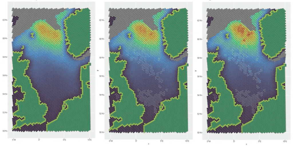
Image: visualisation of the honeycomb model, Laura Thomson, Strathclyde University
Structures continue to displace traditional fishing areas, increasing competition out with these areas. But FISHSPAMMS has shown that man-made marine structures do more than interrupt fishing grounds — they actively reshape fish distributions, densities, and potentially production.
Structures have a broader horizontal range of influence than previously thought. Fish density appears to be linked to the density and size of these structures, suggesting network effects. These findings raise important questions about fishing along structure edges and the balance between fish production and aggregation.
As decommissioning plans move forward, these results are key for weighing the ecological costs and benefits of leaving infrastructure in place versus removing it entirely.